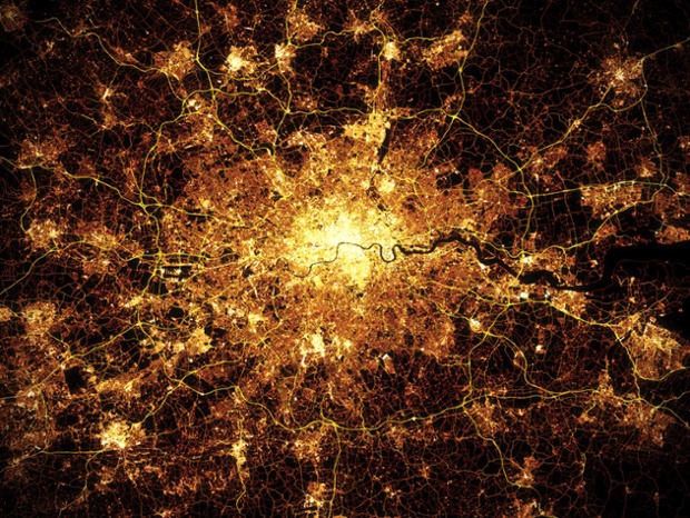
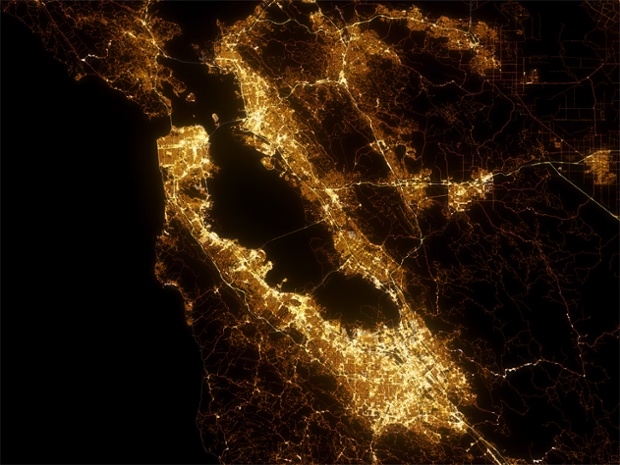
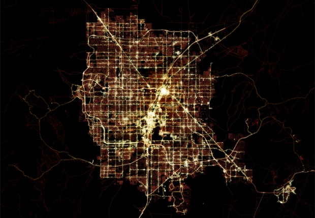
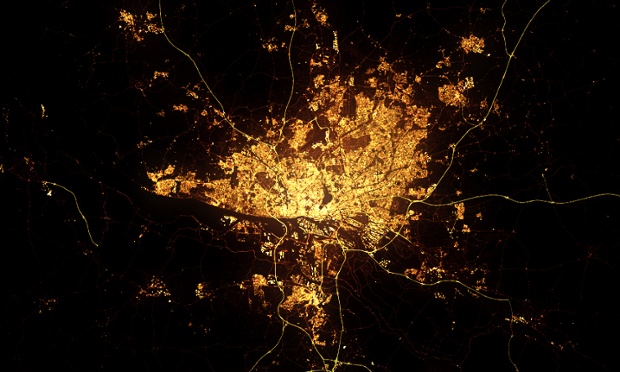
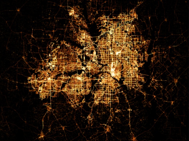
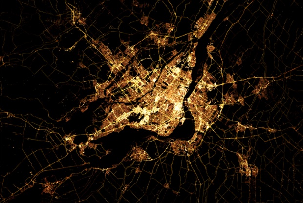
These high-quality images may look like photographs of world cities at night taken by astronauts from the International Space Station – but they are painstakingly constructed from public map data and finessed by artist Marc Khachfe
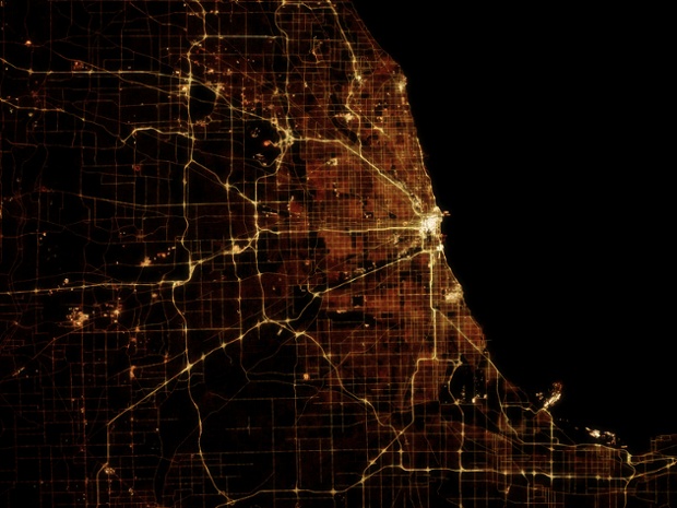
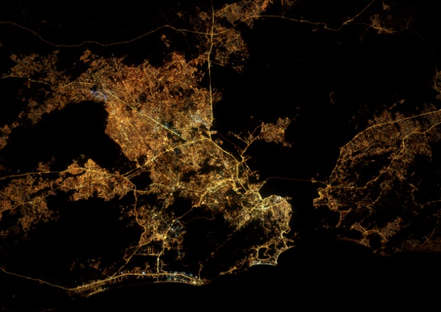
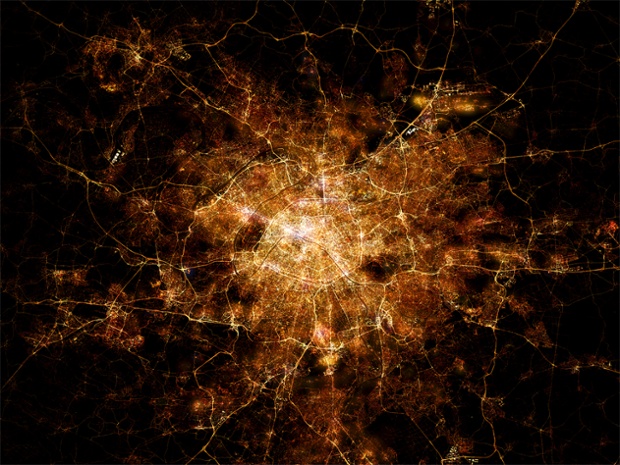
London: When Marc Khachfe saw the stunning photographs of cities from space taken by astronauts from the ISS he wanted to blow up an image of London to put on his office wall – but found they weren’t good enough quality to work in large format.Photograph: Marc KhachfeChicago: So Marc used his skills as a professional 3D animator and 2D compositor to create his own high-quality version of the image.Photograph: Marc KhachfeRio de Janeiro: “I use no images at all in the making of them,” says Marc. “I only keep the photo taken from the ISS open on my desktop for reference.”Photograph: Marc KhachfeParis: Marc finds Open Street Map data on roads, buildings, waterways and coastlines for each city, then uses his skills as a compositor to layer the information with CGI tricks to mimic the glow of streets and buildings.Photograph: Marc KhachfeSan Francisco: “Finally I use PhotoShop to add all the layers together and play around with the colours, glows and so on to augment reality,” says Marc. Photograph: Marc KhachfeLas Vegas: If the data is good enough quality, Marc can finalise an image in around four hours – but things are rarely that straight forward. While road data is usually complete, building data is minimal, and the artist has to fill in gaps by hand.Photograph: Marc KhachfeHamburg: “I very quickly found that every single city requires different approaches to get right,” adds Marc. “I can’t use the same light values, layering and filters or just automate the creation of new cities. Because the density of roads and buildings is different for every city I have to approach each city fresh.”Photograph: Marc KhachfeDallas: Many American cities also have GIS data available, which can help build a more accurate image. “It can take a good while to find the data you want sometimes,” says Marc, “but that’s all part of the fun.”Photograph: Marc KhachfeMontreal: Marc says he has tried to get New York right six times but has never been happy with the result. “The building data is so vast that my machine struggles with it. If I try to cut corners, I’m not happy with the result. I'm a perfectionist.”