As European powers colonialised Africa, they brought cartographers too, keen to picture the "new" continent. These maps show how the West's view of Africa changed
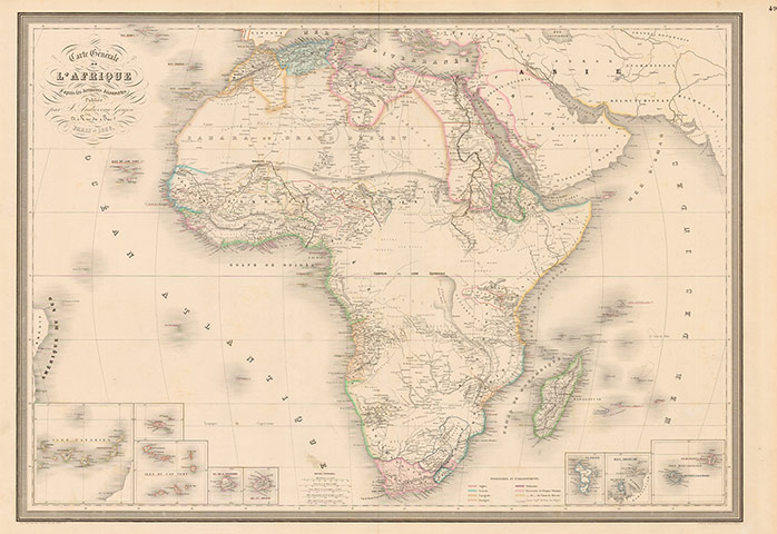
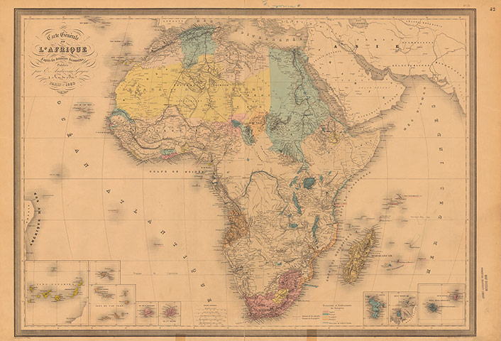
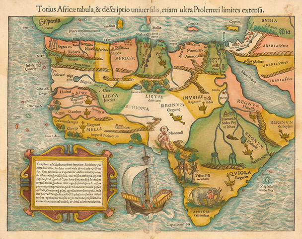
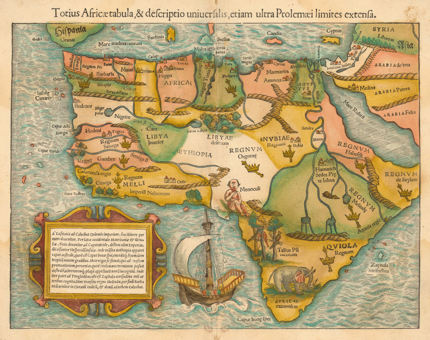
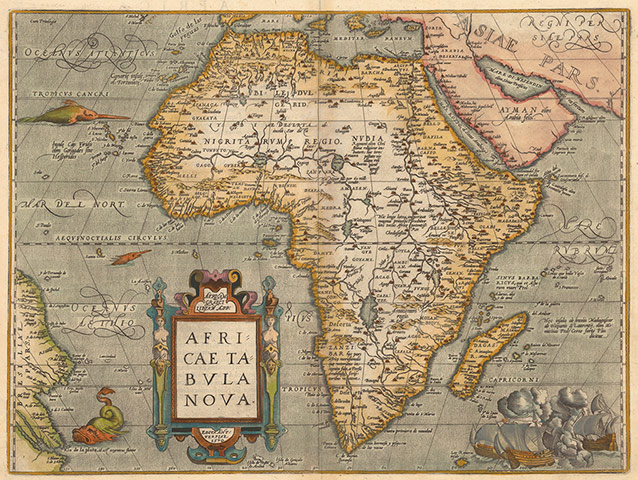
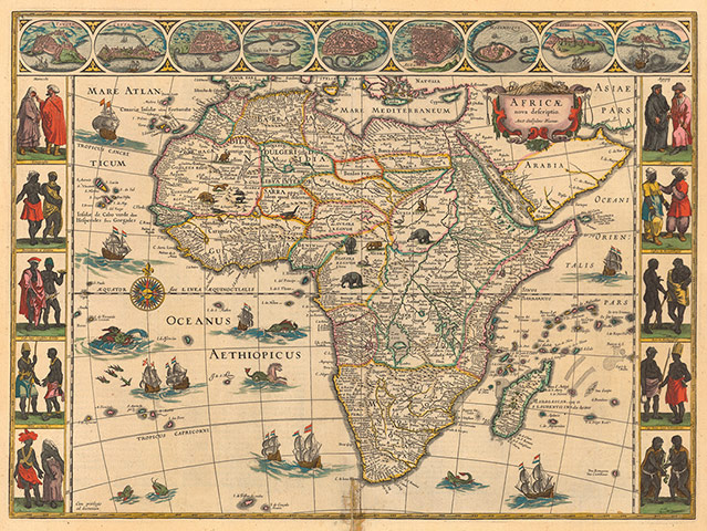
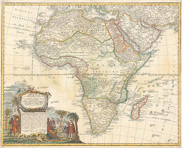
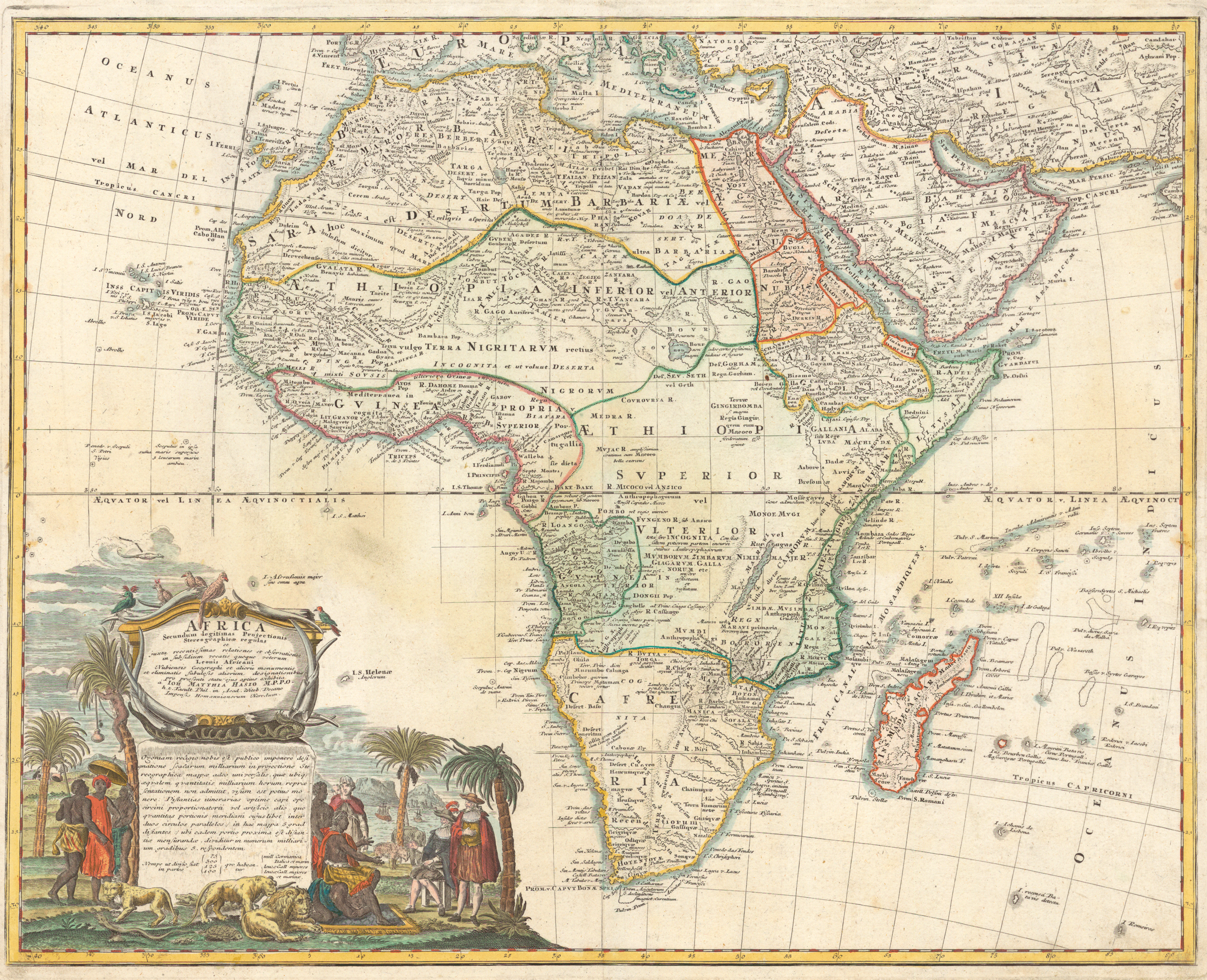
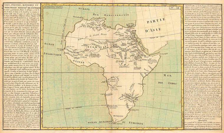
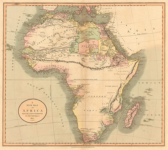
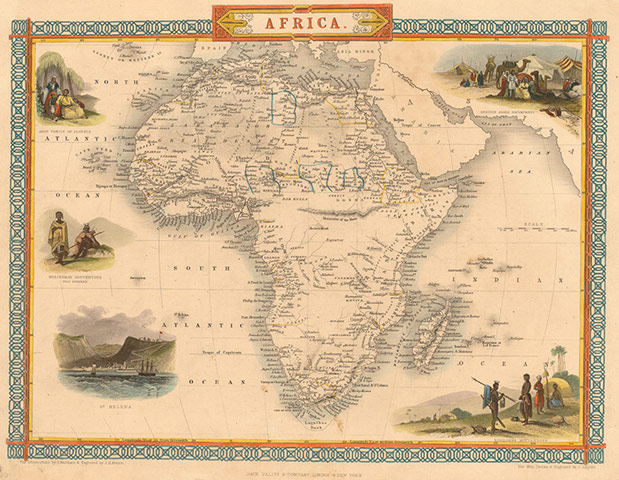
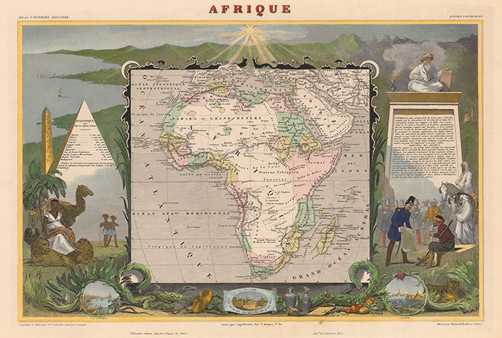
1554: Sebastian Münster. "The earliest obtainable map of the whole continent of Africa … Münster was a professor of Hebrew at Heidelberg and then at Basel, where he settled in 1529 and later died of the plague. By soliciting descriptions and maps from German scholars and foreigners, Münster was the first mapmaker to print separate maps of the four then known continents (Europe, Africa, Asia, America). Fullscreen versionPhotograph: Princeton University1584: Abraham Ortelius. "The standard map of Africa for the last quarter of the sixteenth century … In 1570, Ortelious published the Theatrum, an atlas of fifty-three maps, the first collection of uniform-sized maps depicting all the countries of the known world—the first real atlas. Each map had text on the back describing the country depicted and listing Ortelius’s sources of information. The atlas was phenomenally successful and revered, printed in many editions in seven languages for more than forty years (1570-1612), with an ever increasing number of maps." Fullscreen versionPhotograph: Princeton University1644: Willem Janszoon Blaeu. "One of the most decorative and popular of all early maps of Africa, from the 'golden age' of Dutch mapmaking. First issued in 1630, the map was reprinted many times between 1631 and 1667, appearing in Latin, French, German, Dutch, and Spanish editions of Blaeu’s atlases." Fullscreen versionPhotograph: Princeton1710: Herman Moll. "One of the characteristics of a Moll map is the textual chattiness. Here, for example, above Guinea, he writes: 'I am credibly informed, that ye Country about hundred Leagues North of the Coast of Guinea, is inhabited by white Men, or at least a different kind of People from the Blacks, who wear Cloaths, and have ye use of Letters, make Silk, & that some of them keep the Christian Sabbath.'" Fullscreen versionPhotograph: Princeton1737: Johann Matthias Hase. "In his map of Africa, 'according to the most recent reports and observations,' Hase identifies several territories or kingdoms but not all have been accentuated by the colorist [see the dotted lines]. The central part of Africa is marked incognita; Blaeu’s two lakes have been replaced by a long, narrow one (Marawi) in the general area where future explorers will find Lake Nyasa, which is also called Lake Malawi." Fullscreen versionPhotograph: Princeton1787: JBL Clouet. "A bare-bones school map of the geographic features of Africa as known toward the end of the eighteenth century. Abbé Clouet was a member of the Académie des Sciences of Rouen, and his map suggests what French schoolchildren might have been taught about Africa just before the French Revolution." Fullscreen versionPhotograph: Princeton1805: John Cary. "A turn-of-the-century no-nonsense British map that clearly presents the geographical gaps that will consume the attention of explorers, the majority of them British, for the rest of the century. From his business in the Strand in London, Cary developed a reputation for creating beautifully printed, clean-looking and accurate maps that presented only the most recent geographical information. His General Map (1794) of the British Isles was the first to use Greenwich as the prime meridian, which is the standard observed today." Fullscreen versionPhotograph: Princeton1851: John Tallis. "Issued to coincide with the Great Exhibition of 1851 in London, Tallis’s atlas was regarded as a tour-de-force of the mapmaker’s art, scientific in intent but visually attractive: one of the most decorative atlases of the nineteenth century. The maps were drawn and engraved by John Rapkin, and the vignettes were created and engraved by various prominent artist-illustrators." Fullscreen versionPhotograph: Princeton1852: Victor Levasseur. "First published in 1845, this map underwent little change in subsequent editions through 1869. An interesting contrast to the preceding English map of the same period, this French version appears subordinate to its surrounding pictorial (and political) representations … The decorations, however, are intriguing and revealing. The hot African sun reigns over the continent. On the right, a French military officer is showing an armed Arab a map or other document (a surrender document?), while French soldiers and Arab horsemen look on. Seated above them on a shelf is a turbaned Muslim holding a tablet lettered CORAN (Koran)." Fullscreen versionPhotograph: Princeton1856: J Andriveau-Goujon. This is interesting in contrast to the next map - the quarter century gap covering a period of intense African exploration. Click next to read more. Fullscreen versionPhotograph: Princeton1880: Eugène Andriveau-Goujon. "The quarter century gap between the dates of these two maps was probably the most productive period for African exploration in the history of the continent. The geographic gains from the expeditions of David Livingstone (southern), Sir Richard Francis Burton and John Hanning Speke (lake region), and Henry Morton Stanley (central) are evident in the later map, as is the advance of European influence in (and control of) territories, depicted by the color-coded areas." Photograph: Princeton
